

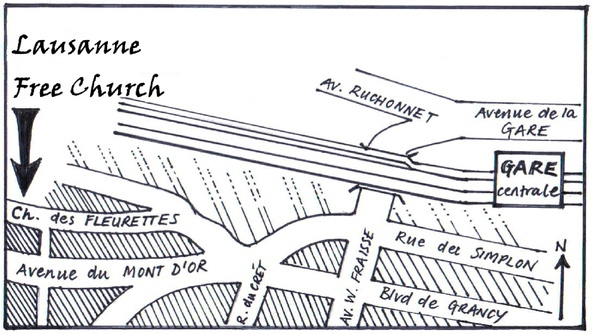
Directions for getting to Lausanne Free Church
The church on Google Maps
For public transport directions:
The church’s address:
Lausanne Free Church
Chemin des Fleurettes 36
1007 Lausanne
Switzerland
View from Chemin des Fleurettes:

Further directions if you are coming by car or train:
By car: There is parking in Chemin des Fleurettes in the marked blue boxes. During the week you need to display a "macaron" showing the time you arrived. This will allow you to park for up to 90 minutes. Most hire cars will have a macaron, which is bright blue with a dial showing a clock, but if you don't have one we have some you can borrow at the church, so please come and ask when you arrive. After 18.30 and on Sundays parking time is unlimited and you do not have to display a macaron. Do not park in any unmarked space or you may get a fine.
There are also plenty of marked spaces in the nearby roads, but if you have trouble
finding somewhere to park come to the church. We can give you advice and a map to
show you where to look. Don't worry about being a bit late for the service -
By train: Lausanne Free Church is 5-